Games Like GeoGuessr: Six Mechanics and Their First Printing
Every geography game runs on one of six mechanics, and each was solved on paper, cardboard or a police form long before anyone loaded a panorama. Tracing them explains what a game trains and how it fails.
Six mechanics, all older than the browser
The genre looks new and its parts are not. Any geography game is assembled from a short list of mechanics: reassembling a map, following a chain of clues, walking a graph of shared borders, narrowing by yes and no, and reading a face against a fixed list. Each of those was solved with paper, cardboard or a printed form well before anyone loaded a panorama, and each has a documented first printing.
Dating them is not nostalgia. Knowing which mechanic a game runs tells you what it trains and where it will break, because the ancestors already show the break. Five of them come with names, years and, in two cases, a retail price. Reading the lineage in order also sorts the current offerings. A game that looks novel is usually an old mechanic with a better camera, and the mechanic, not the camera, decides whether you are still playing it in a month.
Cutting a map to learn it
In 1767 the London engraver and mapmaker John Spilsbury pasted a printed map onto a thin sheet of mahogany and cut along the borders of the countries with a fine fret saw. He called the result a dissected map and sold it as Europe Divided into its Kingdoms for ten shillings and sixpence, at a time when an English labourer earned one or two shillings a day. His catalogue ran to two dozen maps of continents, countries and counties. John Locke had argued for educational toys in the 1690s, and Spilsbury found the parents who had read him.
The mechanic is reconstruction, and its virtue is that every error is immediate: a piece either fits the border or it does not. Dissected maps stayed in use as teaching aids until about 1820, long after the puzzle had become a parlour amusement. What they train is the political map as a set of mutually adjacent pieces, which is also their weakness. The pieces encode one year of borders, so a map recut after a treaty teaches a different set, and the skill transfers less than the sales pitch suggests.
A clue chain instead of a question
The 1985 release of Where in the World Is Carmen Sandiego? put the mechanic on a floppy disk. Broderbund programmer Dane Bigham wanted a menu-driven adventure for children; the artists Gene Portwood, a former Disney animator, and Lauren Elliott gave it a look; co-founder Gary Carlston pushed the theme toward geography after travelling in Europe as a boy. Writer David Siefkin built the clue chain out of the World Almanac, and the box shipped with a copy of it. Thirty countries, one thief, an arrest at the end if the reasoning held.
It sold four million copies in its first decade and was named Best Learning Product of 1985 by the Software Publishers Association, and the public television version that began in September 1991 ran for 295 episodes. The mechanic is a chain: each answer supplies the next question, so one bad inference poisons every step after it. The almanac in the box was the honest part. The game did not know the answer either; it taught you to go and look.
Borders as the board
The graph mechanic arrived in 1957 with La Conquete du Monde, designed by the French film director Albert Lamorisse, who had just won an Academy Award for The Red Balloon. He patented it in 1954 and sold it to the publisher Miro, where Jean-Rene Vernes simplified the combat; Parker Brothers brought it to the United States in 1959 as Risk: The Continental Game. The board holds 42 territories in six continents, and armies may only move into a territory that touches the one they left.
That rule is the whole design. The world map printed on the board is decoration over an adjacency graph, and the graph is what players learn: a handful of corridors decide most campaigns, because a chokepoint is a fact about the drawing rather than about the terrain. The weakness is the same as the strength. A territory that has since split into five still counts as one cell, so a 1959 board teaches a 1959 world.
Narrowing by yes and no
Twenty Questions is older than any of this and better documented than most. Hannah More recorded teaching the play of twenty questions at a London dinner in 1786, with Joshua Reynolds and Lord North among the guests. George Canning demonstrated it to the American envoy Richard Rush in 1823, and Rush carried it home; Dickens put a version into A Christmas Carol, where the answer turns out to be Scrooge. An American radio panel show of that name started on 2 February 1946.
The arithmetic explains the format. Twenty questions that each split the remaining field in half separate 2 to the 20th possibilities, which is 1,048,576, and that is why the good question is the one that cuts the field roughly down the middle rather than the one that sounds clever. Coarse geography variants keep the mechanic and weaken the feedback: a heat colour is not a bit, so the player has to guess how the gradient maps onto distance, and the strategy becomes patience rather than halving.
A face described from a fixed list
The last mechanic is the oldest to be formalised and the one with the worst record. Alphonse Bertillon introduced anthropometric identification to the Paris police in 1879 and by 1884 had used it to catch 241 repeat offenders who had given false names. His 1885 Instructions signaletiques added the portrait parle, which paired front and profile photographs with a standard vocabulary for forehead, nose, ear, chin and iris, so that a clerk in another city could rebuild a face from words. Fingerprints replaced it, needing no trained describer and no vocabulary.
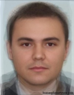
The catalogue behind this site's face branch has the same architecture as that form: a name, a region, a list of traits drawn from a fixed vocabulary, and a bibliography. Gorid, named for the Polish word for mountain, is defined as metrically intermediate between West Alpinid and East Europid. Mtebid, from the Georgian word for mountain, is read as a probable Alpinised Dinaro-Armenid and carries the lowest nasal index in its region. Norid, named for the Roman province of Noricum, is a Dinarid-like form with lighter pigmentation.
Those three definitions share a habit that matters. Each is stated partly by reference to its neighbours, so the list is a grid of relative positions rather than a key that unlocks a face. A grid can describe the middle of a range and the two ends of it. It cannot say which cell a particular person occupies, because the boundaries between cells are drawn through populations rather than around them. Bertillon wanted the key, and it did not work. What the catalogue claims is smaller: a region and a date, never a person.
Which ancestor your taste comes from
The practical use of the lineage is choosing what to play. If the pleasure is fitting pieces until the picture closes, a click-to-label drill is the descendant to take, because it corrects you on the spot instead of at the end. If the pleasure is the chase, take a daily single-answer puzzle, which is the clue chain with the almanac removed and the clock kept.
The composite-face branch occupies a different position from the rest, and it is worth being explicit about why. Every other mechanic on this list uses a map of the present or of a recent past, and each has aged in the ordinary way as borders and imagery changed. A historical catalogue does something else: it describes a baseline of roughly 1,500 years ago, which means the migrations that built the modern map, from the Atlantic trade to the industrial movement into cities, are outside its frame on purpose.
- For reconstruction, a blank-map drill; the feedback is instant and the border set is the lesson.
- For the chase, a one-round daily puzzle; the reasoning is the same, the almanac is gone.
- For adjacency, a border-chain puzzle; you are walking the 1959 graph with a new map underneath.
- For narrowing, a heat-scale guess; expect a gradient rather than an answer, and plan to be patient.
- For faces, the catalogue; it names a region and a century, and it will not name a person.
Frequently Asked Questions
- What is the oldest game mechanic behind modern geography games?
- Reconstruction. John Spilsbury, a London engraver, cut a printed map along national borders in 1767 and sold it as a dissected map for teaching geography, at ten shillings and sixpence when a labourer earned one or two shillings a day. Dissected maps stayed a classroom aid until roughly 1820. Every later format inherits something from that idea: a fixed answer key, a visible error, and a map that encodes one particular year of borders.
- Why do border-chain games feel different from map quizzes?
- Because they run on a graph rather than on distances. Risk introduced the rule in 1957, with 42 territories where armies could only move between neighbours, and the same rule now drives puzzles where each answer must touch the last. Nothing about area or shape helps you; what helps is knowing the chokepoints. The catch is that the graph was drawn for a particular decade, so a territory that has since split still counts as a single cell.
- Is guessing a region from a composite face reliable?
- As a game it works, because visible traits change gradually across space instead of stopping at borders. As an identification method it does not, and the historical attempt is instructive. Bertillon's portrait parle tried to name an individual from a standard vocabulary of features and was replaced by fingerprints, which required no trained describer. A catalogue entry states a region and a historical baseline, never a person, and that limit is what keeps the game honest.
Related Phenotypes
Faces from the encyclopedia that appear in this article. Open any entry for its full description, distribution, and references.
Gorid
Central Europe
East Alpinid variety, named after the Polish word for mountain (Gora). Metrically intermediate between West Alpinid and East Europid. The nu...
Mtebid
Caucasus
Regional type of the Caucasus Mountains. Probably an Alpinised Dinaro-Armenid adapted to life in mountainous regions. Mtebids are typical of...
Norid
Southeastern Europe
Central European type that closely resembles Dinarids except for lighter pigmentation. Authors interpret this to be the result of Nordid and...
Test what you learned
Put your eye for regional faces to work in the daily quiz — a composite face, a world map, and your best guess.