Ethnicity Guesser Game: How the Answer Space Shapes a Round
A face-mapping game scores an answer three ways: a point on the map, a named catalogue entry, or a modern country. Which unit it picks decides how hard a round feels and what a correct guess can mean.
The Decision Every Face Game Makes First
Every face-mapping game settles one question before it can score anything: which answer counts as right. A round can ask where the documented pattern was recorded, which catalogued entry fits best, or which present-day state the face came from. Those are three different questions wearing the same interface, and the choice moves the difficulty of a round further than any timer or scoring curve does.
The catalogue behind this site holds two kinds of record, which is what makes the choice visible. There are 209 entries describing documented appearance patterns, each named and placed on a map. There are 48 country pages built from composite portraits. One set is a historical index of patterns recorded in the literature; the other is a modern summary built from photographs. A game that scores answers has to say which of them it is scoring against.
Three Kinds of Answer a Map Can Score
Score the answer as a point and the unit is a distance. GeoGuessr, released in 2013 by the Swedish developer Anton Wallén, scores a guess by great-circle distance from the true location, with full credit inside roughly 150 metres and decay from there. Twenty kilometres off in an Alpine valley and twenty kilometres off on the Kanto plain produce identical scores, though one miss puts you in the next village and the other in the same city.
Score it as a catalogue entry and the unit is a name, drawn from a vocabulary of 209 items. That is closer to a two-hundred-option multiple choice question than to a map, and the options differ by degree rather than by kind. Score it as a modern country and the unit is a state: 48 options, with a prior that is far from even. The three formats can live on one page, but they are not interchangeable, and a score in one says almost nothing about performance in another.
Why a Map Point Is an Awkward Unit
Distance on a world map is not uniform. A degree of longitude measures 111.32 kilometres at the equator, about 91 kilometres at 35 degrees north, and 55.6 kilometres at 60 degrees north. The web Mercator projection used by most map tiles stretches area by a factor near 1/cos(latitude), which is why Greenland is drawn larger than Africa while holding roughly fourteen times less land.
A score built on distance inherits those distortions. A fixed pixel radius over Kyushu, near 32 degrees north, covers fewer kilometres than the same radius over Lapland at 68 degrees north, where a degree of longitude falls to about 41 kilometres. There is a second problem: the entries themselves are distributions, not addresses. Each one is a documented historical range with a centre, so a guess is always measured against a centroid, and part of the gap between guess and truth is simply the width of the range.
What Naming an Entry Adds
Naming an answer makes it checkable. A player can be told the right word, look it up, and see why a face was filed under it. That vocabulary is a historical artefact rather than a natural one: Homo indicus was coined by Bory in 1825, Yakonin by Weisbach in 1878, Choshiu and Satsuma by Baelz in 1883, Litorid from Deniker's Littoral of 1900, with Eickstedt's surveys in the 1930s, Lundman's revisionary work in the 1950s and 1960s, and Knussmann's handbook of 1996 filling out the rest.
Keeping those names has a cost. Several carry the assumptions of the period that produced them, and some describe one pattern as a softened or robust version of another, which is a comparison inside the literature and not a claim about value. The catalogue keeps them as index keys, the way a library keeps outdated subject headings, because a name that people have used for a century remains the fastest route to the thing itself.
Why the Answer Space Is Uneven
The 209 entries are not equal-area tiles spread evenly over the planet. Counting them by the region they are filed under gives 22 for East Asia, 17 for Sub-Saharan Africa, 16 each for South America and South Asia, 15 each for Siberia, West Africa and East Africa, and then a long tail of 2 in the Middle East, 2 in South Africa, 1 in the Caucasus and 1 in the Arctic. Those totals follow the geography of nineteenth and twentieth century field surveys, and the funding behind them, rather than the geography of human settlement.
Individual entries are just as uneven as the regional totals, and the area a single name covers can be one mountain range or half a continent, because each name was assigned to wherever a researcher happened to be working. Four examples from four different regions show how wide that spread runs, and each of the four has its own page in the catalogue:
- Litorid is filed under the Middle East, yet its documented range runs from Lebanon and southern Turkey through Cyprus, Greece and Italy to the French Atlantic coast, Wales and Frisia.
- Inuid is filed as Arctic and covers Alaska, Nunavut, Labrador and Greenland, making it the northernmost entry in the catalogue.
- Paleo Saharid is filed under South Africa while its description places it across the Sahara, from the Tibesti mountains to the Haratin of the Maghreb.
- Jahai Semangid covers a few hundred people in the forests of the Malay Peninsula, the smallest documented population of any entry.
The Map Has Kept Moving
The catalogue describes distributions as they stood roughly 1,500 years ago, and the centuries since moved a great deal of what it records. Around 281 million people lived outside the country of their birth in 2020 by United Nations estimates, and more than half the world's population now lives in cities rather than in the rural settings where most of these patterns were first described. Shipping lanes, railways and aviation compressed the old routes out of recognition.
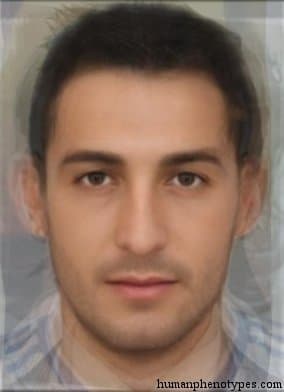
Composite faces sharpen the mismatch. An average portrait is assembled from many photographs, so it carries the mean of a sample plus the geography of whoever was photographed. A round therefore tests whether a player can place the centre of a documented pattern, not whether a face belongs to anyone in particular. That distinction is the reason the game is playable at all.
What a Round Can and Cannot Teach
What the game rewards is map literacy: knowing roughly where the Ural Mountains run, that the Atlantic coast of Europe turns a corner at Brittany, that the Sahara is wider than the Mediterranean. It also builds a habit of mind, the recognition that appearance varies gradually across space rather than in blocks, which is what Livingstone argued in 1962 when he wrote that there are no races, only clines, and what Lewontin later quantified by finding most human genetic variation inside populations rather than between them.
A round cannot tell you what anyone is. It cannot look at a face and return a nationality, and it cannot sort people into kinds, because the categories it uses are index keys to descriptions rather than biological boxes. What it can do is give a face a location in a catalogue compiled by people who walked, measured and wrote, and then let a player see how loose that fit really is.
Frequently Asked Questions
- Is an ethnicity guesser game just a geography quiz?
- It borrows the format. A geography quiz scores a point on a map, and so does a face-mapping game, both using great-circle distance as the unit. The difference is the question underneath: one tests where a place is, the other tests where a documented appearance pattern was recorded. Both reward the same underlying skill, an internal sense of the world's shape, which is why a strong geography player usually improves at face rounds quickly.
- Why do two face games score the same photo differently?
- Almost always because the answer space differs. One game may score a point on the map, another may ask for a named catalogue entry, a third may ask for a modern country. The same guess can be close in kilometres and wrong in vocabulary, or correct in word and far away in distance. The scoring curve adds a second difference, since full credit within 150 metres and full credit within 100 kilometres are not the same measurement.
- Can I improve at the game without memorising 209 names?
- Yes, and most strong players never learn the full list. Distance intuition comes from repeated guessing and correction, and latitude carries more information than longitude, because the length of the growing season, the angle of the sun and the shape of coastlines all narrow the band a face can belong to. Twenty well-documented entries learned properly will outperform a shallow acquaintance with two hundred.
Related Phenotypes
Faces from the encyclopedia that appear in this article. Open any entry for its full description, distribution, and references.
Litorid
Middle East
Type of coastal European regions that contains Mediterranid and Dinaro-Armenid elements. Probably the result of ancient migrations from Asia...
Inuid
Arctic
Eskimid proper type, ranging over the vast, sparsely populated tundra along the icy coasts of Alaska, Nunavut, and Labrador (Canada) to Gree...
Jahai Semangid
Southeast Asia
Semangid variety, a Paleolithic relict of the original Malaysian forest population. Shows more Veddoid/Australoid features and is similar to...
Paleo Saharid
South Africa
Very ancient type native to the Sahara Desert. Related to Proto Ethiopid, but possibly also shows traces of ancient Khoisanids who were more...
Test what you learned
Put your eye for regional faces to work in the daily quiz — a composite face, a world map, and your best guess.