Guess the Nationality: What 48 Country Average Faces Actually Show
National average faces converge with geography - neighbors look alike because populations mix along the routes terrain allows. What composite-by-country studies found, and how our Countries mode turns it into a game.
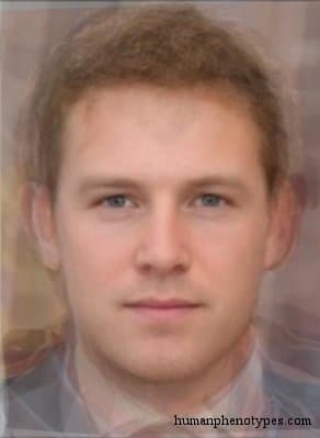
The Strangest Family Album
A national average face is one of the internet's favorite artifacts: a composite built from many faces said to come from one country, calm and symmetrical and faintly familiar, like a passport photo issued to a place. The images are striking precisely because they seem to promise something no statistic can deliver — the face of a nation. What they actually deliver is a summary: the center of a sample, photographed by mathematics.
So the right question about a national average is not 'is this what people there look like?' but 'what does this average actually summarize?' Our Countries mode is built on 48 of these composites, and it plays best — and most honestly — when you understand what the pictures are: not portraits of populations, but geographic documents that say more about where a country sits on the map than about the nation that holds the map's colors.
How a Country's Average Face Is Made
The recipe is Francis Galton's, from the composite photography he demonstrated in the 1870s, updated with software: take a sample of individual photographs, mark the same landmarks on each — pupils, tip of the nose, corners of the mouth — and deform every face onto a shared grid; average the landmark positions into a single geometry; then warp each photograph onto that geometry and blend the pixels. The result is the statistical center of the sample: a face no one person has, but which every face in the sample votes for. We keep a fuller account of the method — including the flattering symmetry and smoothness that averaging adds — in our article on how average face composites are made.
Two properties of that recipe matter for countries. First, an average is only as representative as its sample: photograph one city, one age group, one lighting setup, and that bias quietly becomes 'the national face.' Second, averaging erases variance by design — a country made of broad-faced and narrow-faced people averages into a medium face that matches nobody. Both properties push toward the same conclusion: these are documents about distributions, not people.
Averages Follow Geography
The experiments that popularized national averages — including the well-known web demonstrations by FaceResearch.org, which let the public explore averages by nationality — kept landing on one finding: the averages converge with geography. Neighboring countries' composites look alike, and the resemblance fades with distance. That is not an accident of the photographs; it is population structure. People have always mixed along the routes that terrain allows, so similarity decays with distance in the way the geneticist Sewall Wright formalized in 1943 as isolation by distance.
Terrain writes the rules. Plains, river valleys, and coastlines are corridors; mountain ranges, deserts, and open sea are walls, each with its tolls and its leaks. That is why a country's average face is finally a geographic statement: it summarizes wherever the ancestors of a country's residents could conveniently reach — and no further. The map, not the flag, decides the resemblance.
Two Confounds Worth More Than the Map
First: within-country variation dwarfs between-country averages. Measure faces inside any one country and you find enormous diversity, because most human variation — genetic and facial alike — sits within populations rather than between them, the pattern Richard Lewontin demonstrated in 1972 and which repeated measurements have kept finding since. The national composite is the center of a very large cloud; the average hides almost all of it.
Second: a country is a political container for mixed populations. Borders cut across gradients that ignore them — some borders centuries old, some barely a lifetime — and most modern nations are accretions of migrations, conquests, and remixtures that no average can unmix. The 48 composites in the Countries mode are therefore starting points, not national faces: ways to locate yourself on a gradient, never claims about what any country's people look like.
How the Countries Mode Works
In Countries mode, you face rounds built on the 48 country average faces, with flag-based answer choices: a composite appears, and you pick which country it belongs to. The trap is treating this as flag trivia. The winning habit is gradient-thinking — the mode quietly teaches the same lesson the averages themselves teach:
- Place the region before the country. Pin the composite on the mental map first — northern Europe, the Andes, East Asia — then choose among that region's flags.
- Trust coarse features before fine ones. Broad gradients in skin tone, hair form, and eye color travel predictably with latitude and climate; let them narrow the map before you commit.
- Expect neighbors to resemble each other. Adjacent countries average out alike, so the mode rewards knowing which side of a gradient a country sits on.
- Eliminate by absence. A trait the composite lacks — a strong contrast between hair and skin, say — rules out whole regions where it is typical.
The Right Way to Read a National Average
Read a national average the way you would read a mean temperature: useful, honest, and not a forecast for any particular day. It is a population's center of gravity, photographed by mathematics — a summary of where a country's people's ancestors were mostly drawn from, as of the sample and the era that produced it.
The game makes the gradients visible; it never certifies nationality. A composite cannot hold a passport, and no face, averaged or individual, can tell you where a person is from — only where certain documented patterns were once common. What the 48 averages can teach is the single most useful fact of human variation: it is arranged in slopes, and countries are the lines drawn across them.
Frequently Asked Questions
- Are country average faces real people?
- No. Each is the statistical center of a set of aligned photographs — a shape and texture nobody has. Treating one as a portrait is like treating the average household size as one particular family.
- Why do neighboring countries' averages look so similar?
- Because populations exchange members along the corridors terrain allows — isolation by distance, as Wright called it. The farther apart two populations are, the more their averages drift apart, so neighbors' composites naturally resemble each other.
- Can a national average face tell me someone's nationality?
- No. Most facial variation lies within any country, and borders cross gradients that biology ignores. The mode practices geography with composite faces; it never profiles people.
Related Phenotypes
Faces from the encyclopedia that appear in this article. Open any entry for its full description, distribution, and references.
Anglo-Saxon
Northern Europe
North-West European type, similar to Trønder, but with a stronger Hallstatt component. Was typified by the ancient Germanic tribes of Angles...
Borreby
Central Europe
Ancient Northern European variety. Named after some of the Neolithic Borreby skulls of Denmark (not all!). Some emphasised resemblance with ...
Test what you learned
Put your eye for regional faces to work in the daily quiz — a composite face, a world map, and your best guess.