Geography Games Like GeoGuessr: Six Kinds of Clue
Street panoramas, country outlines and average faces all answer one question. Here are six geography games sorted by the clue they hand you, and what each one actually trains.
One question, six kinds of clue
GeoGuessr opened a genre in 2013, and the games that followed differ less in subject than in the clue they hand you. One gives you a street corner, another a country outline, a third a colour that runs from red to pale. The choice of clue decides what the game actually trains. Reading architecture and road markings is a different skill from recalling which countries touch each other, and both are different from holding a mental map steady while you narrow a search. Sorting the family by clue explains more than a ranked list would, because two games can look like twins and reward entirely different knowledge. The six below run from the most visual to the most abstract, ending with a branch that uses a human face as the fragment.
Street imagery, the founding clue
The founding clue was borrowed hardware. Google published the first Street View panoramas on 25 May 2007, covering five American cities, and a decade later the imagery ran to more than ten million miles of road across 83 countries. GeoGuessr, built by Swedish developer Anton Wallén in 2013, dropped players somewhere inside that library with no more instruction than the question of where they were. What players learn to read is leakage: the shape of bollards, the markings on the road, script on shopfronts, the angle of sunlight, the grain of the camera. None of it was placed there as a clue, which is why the game feels like deduction rather than recall.
The catch is that a panorama is a dated document. Imagery layers from different years sit on top of one another, so a round can show a street that has since been rebuilt, a sign that no longer exists, or a junction photographed before a bypass took the traffic away. Experienced players treat the image as a photograph with a timestamp rather than a present-tense view of a place. That habit is worth carrying into every other game on this list, including the ones whose clues come from records rather than cameras, because all of them describe a world at some particular moment and none of them describes today.
Outlines, warmth, and blank maps
The daily format popularised by Wordle produced two geography descendants in January 2022. Worldle, built by French developer Antoine Teuf, shows the silhouette of one country or territory and grants six guesses; every wrong answer returns a distance and a direction, and settings let a player hide the outline entirely or rotate it to a random bearing. Distances are measured between territory centres, so the game's own notes point out that the United States and Canada sit about 2,260 km apart despite a shared border. That single design choice is the whole game: recognition, plus a growing sense of relative position.
Globle, released the same month by Toronto developer Abe Train under the label Trainwreck Labs, takes the opposite approach and removes both the outline and the numbers. You type a country; it fills with a colour from a heat scale, deep red when you are close to the answer and pale when you are not. Guesses are unlimited, so the puzzle rewards patient narrowing rather than a lucky opening, and the feedback is deliberately vague enough that you have to hold a region in mind rather than follow an arrow. Train has credited both Wordle and Sporcle's older Secret Country games as the inspiration.
Seterra works differently again, and it predates all of them. It began in Sweden in the 1990s as a Windows map quiz written by Marianne Wartoft, became a fixture in Swedish classrooms, and now runs in a browser with roughly 400 quizzes across 45 languages. There is nothing to deduce: the game names a place and you click it on a blank map, with three attempts per answer and the missed location lighting up afterwards. It is the genre's plainest form, closer to a drill than to a puzzle, and it is the one teachers most often hand to students.
Chains of borders
Travle strips away the visual surface altogether and leaves adjacency. You are handed a start country and a destination, then name countries between them, and each new name has to share a land border with the chain you are building; adjacency is derived from map geometry rather than a curated list, so two countries facing each other across water do not connect. Your result is compared against par, the fewest borders the route could use, which turns the game into a search for bottlenecks. Turkey links Europe to Western Asia, Panama links the Americas, Egypt links Africa to the Middle East, and knowing those three answers a great many puzzles. Irish developer Oisin Carroll first floated the format in 2023, and it is now published by Teuteuf Games, the studio behind Worldle.
Portraits as map clues
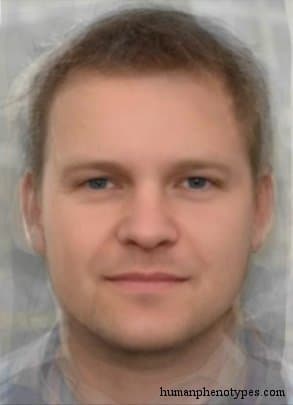
The newest branch swaps scenery for a face. Instead of a street corner you get a composite: many portraits scaled to a common frame, aligned on the eyes and mouth, and averaged until only the shared architecture survives. A composite carries location information because visible traits grade across space rather than appearing in blocks, so it reads as a region rather than as a person. The reference set behind this site's version is a catalogue of 209 documented appearance patterns, each with a recorded region, a short list of traits, and a historical baseline of roughly 1,500 years ago. Four entries show the spread.
- Borreby, recorded in Central Europe and named after the Neolithic skulls found in Denmark.
- Indo Iranid, a contact type described across Pakistan, Iran and Afghanistan, and noted in its source as not yet stabilised.
- Chopi-Tswana, a Sub-Saharan African pattern shaped where the Bantu expansion absorbed older Khoisanid elements.
- Arizonid, a North American contact type that grew more numerous once horses returned to the prairie.
Where the maps have moved
Every game above assumes a present-day world, and the first two assume a photographed one. That is where the friction sits. Street imagery is replaced unevenly, so a round can be years out of date; borders are redrawn by politics, which makes a silhouette a moving target and explains why disputed entries in these games attract complaints. A historical catalogue has the opposite problem: its baseline of roughly 1,500 years ago deliberately excludes the migrations that produced the world the other games depict, from the forced movement of enslaved people across the Atlantic to the industrial-era emigration that filled the Americas. Neither kind of clue is wrong, but a player who loses track of which era the answer belongs to will misread the map.
Which clue suits which player
If you enjoy visual detection, start with street imagery, where the reward is noticing what you did not know you had learned. If you want a bounded daily ritual with a score you can compare, the outline and warmth games deliver it in five minutes. If you are studying for an exam, naming places on a blank map still moves facts into memory faster than anything else here. And if what interests you is variation across regions rather than one location, the composite branch is the one that opens a reference library instead of a single answer. Each format trains something different, and none of them settles where any living person is from.
Frequently Asked Questions
- What is the difference between GeoGuessr and Worldle?
- GeoGuessr drops you into a Street View panorama and asks where in the world it is, so the answer space is the entire planet. Worldle gives you the silhouette of one country or territory and six guesses, returning distance and direction after each attempt. One trains visual reading of streets and signage; the other trains shape recognition and a feel for relative position on a map.
- Is there a game like GeoGuessr that uses faces instead of places?
- Yes. The composite-face branch asks the same question with a different clue: an unlabeled average face appears and you drop a pin where that pattern was documented. The faces are composites, not photographs of any individual. Because visible traits change gradually across space, neighbouring entries overlap heavily, so scoring rewards landing in roughly the right region rather than naming one exact entry.
- Do these games measure knowledge or luck?
- Mostly knowledge, with a structural bias toward large and well-connected places. Big countries and famous cities turn up in more puzzles and generate more useful feedback when a guess is wrong; small islands and landlocked microstates are harder to reach by reasoning alone. That unevenness belongs to the map rather than to the player, and the formats are not interchangeable, so a strong street-imagery player is not automatically strong at border chains.
Related Phenotypes
Faces from the encyclopedia that appear in this article. Open any entry for its full description, distribution, and references.
Borreby
Central Europe
Ancient Northern European variety. Named after some of the Neolithic Borreby skulls of Denmark (not all!). Some emphasised resemblance with ...
Indo Iranid
South Asia
Relatively recent contact type with a position intermediate between Indo Brachid and Iranid. Widespread in Pakistan, Iran, and Afghanistan, ...
Chopi-Tswana
Sub-Saharan Africa
Bantuid variety, overall similar to Central Bantuid, but with weak Khoisan influence, placing it closer to Xhosaid. Developed as a result of...
Arizonid
North America
Relatively recent North American contact type. Started to develop as Athabaskan speakers of Canada migrated South during late Pre-Columbian ...
Test what you learned
Put your eye for regional faces to work in the daily quiz — a composite face, a world map, and your best guess.