Country Guessing Game: The Margin Around Each Answer
A country guessing game is a set of seeds, each owning the ground nearest it, and the margin at each seed is half the gap to its closest rival.
Every answer owns a cell
A country guessing game looks like a quiz and behaves like a partition. Give it a fixed list of answers, place each one at a coordinate, and the map divides itself: every point on it belongs to whichever answer is nearest. The line separating two answers is the perpendicular bisector of the line joining them, which is a fact about geometry rather than about the rules of any particular game. Georges Voronoi described the construction in 1908, and the Dutch climatologist A. H. Thiessen applied the same idea in 1911 to average rainfall from scattered gauges.
The cell around an answer is the ground on which that answer wins. Its size is set by the neighbours: an answer ringed by rivals gets a small cell, and an answer in an empty quarter gets a large one. Nothing in the interface reveals this. A player sees a map, drops a pin, and receives a score, and the reason one round feels generous while another feels like a knife edge is written into the spacing of the answer list long before anyone plays.
The margin is half the nearest gap
The number that matters is the margin. Stand on a true answer and walk in any direction: you stay correct until you cross a bisector, and the closest bisector is halfway to the nearest other answer. The margin is therefore half the distance to that neighbour. The country quiz on this site carries 48 answers, and their nearest-neighbour gaps run from 190 kilometres to 7,000. The median gap is 688 kilometres, which puts the median margin at 344.
Twenty of the 48 answers have a margin under 250 kilometres, and 25 sit under 400. The tight end is where the game becomes hard in a way no timer captures. Belgium and the Netherlands are 190 kilometres apart at the points this site stores for them, so a pin more than 95 kilometres from Brussels on the wrong side of the line belongs to the other answer. Austria and the Czech Republic are 265 apart, Israel and Lebanon 326, Poland and the Czech Republic 348, Portugal and Spain 399. In each case the margin is a hundred to two hundred kilometres, which on a world map is a few millimetres of hand movement.
A country is not a point
The margin exposes an assumption inside the format. A country is a polygon and the game needs a point, so somebody has to choose one, and the choice is not neutral. The United States entry in this site's country file sits at 37.09 north, 95.71 west. The Census Bureau placed the country's 2020 centre of population in Wright County, Missouri, roughly 321 kilometres east of that. Both points are defensible and a pin near either is scored the same way, but the distance between them measures how much room there is inside the word centre.
The extremes make the same point. Brazil's nearest other answer is Morocco, 7,000 kilometres away, so its margin is 3,500 and almost any pin inside South America scores well. Sixteen of the 48 answers have no other answer within 1,000 kilometres. The Netherlands has eleven. One scoring rule applied to both ends is running two different tasks and calling them one game.
Where the answers are is the difficulty
The distribution of margins follows the distribution of answers, and that follows a photographic record rather than a plan. Twenty-two of the 48 are European, six Middle Eastern, five Southeast Asian, four South Asian, four Sub-Saharan African, three East Asian, two North African, and one each for North and South America. Central Asia and Oceania are absent altogether, and the Americas are represented by two pages. Russia is filed under Europe, which is a filing decision and not a description of where its land sits. The consequence is arithmetic: the median nearest-neighbour gap among the European answers is 415 kilometres, and among the rest it is 1,059. Eighteen of the 22 European answers have a margin under 250 kilometres. Two of the other 26 do.
None of that is a statement about countries. It is a statement about who was photographed, and when. The composites behind these 48 pages were assembled from photographs taken in recent decades, the entries in the catalogue describe distributions reconstructed for roughly 1,500 years ago, and the borders that generate the cells were drawn within living memory of the twentieth century. Three layers of different dates are being read as one map, which is why the line that decides a round can be a treaty rather than anything about the ground.
The catalogue has the same geometry
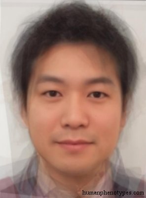
The catalogue this site publishes runs into the identical problem, because it is also a set of seeds with margins. Chikuzen is recorded for the northern half of Kyushu, and Satsuma for Kagoshima, Shikoku, Honshu and the Ryukyus. Their recorded centres sit 215 kilometres apart on one island, which leaves each a margin of about a hundred. A face placed between them is being asked to resolve a distinction the map barely separates, and the Chikuzen entry concedes as much by describing itself as probably a Mongolised variant of the robust Tsukumo type of the Neolithic.
Other entries show the opposite mismatch. Paleo Sardinian survives as a minority element in the mountains of Sardinia and is described as morphologically similar to Berberid while genetically different, so its geographic margin is wide and its morphological margin is narrow. Insular Melanesid covers an archipelago from East Papua to Vanuatu, which makes its margin wide and its internal variation large. Senegalid takes its name from Senegal, is recorded in its purest form among Wolof, more mixed among Serer, and extends across the Sahel. A name can be narrower than its distribution or wider than its resemblance.
What to learn first
The margins tell a player where to spend effort. A list that is not evenly spaced should not be studied evenly: the tight pairs are where a small clicking error and a small spacing error arrive at the same place, and they are also where the vocabulary of the game runs out. Four rules follow from the arithmetic, and each of them is a consequence of the bisector rather than of anyone's design preference.
None of this changes what a country quiz is. It is a partition of a map into cells, scored by distance, over an answer list that was assembled for reasons of its own. Knowing the margins converts the game from a test of memory into a test of spacing, which is the part it was always measuring and the part a player can actually prepare for.
- Learn the tight pairs first: Belgium with the Netherlands, Austria with the Czech Republic, Israel with Lebanon, Portugal with Spain.
- Then bank the wide margins, where precision is nearly free: Brazil, the United States, South Africa, Russia.
- Treat a near miss inside a 150 kilometre margin as a correct answer the map could not separate.
- When a round feels unfair, check the neighbour before blaming the pin.
Frequently Asked Questions
- Why do some answers in a country guessing game feel much harder than others?
- Because the answers are not evenly spaced, and the difficulty of a round is set by the gap to the nearest other answer rather than by the size of the country. A pin has to land on the correct side of the bisector between two answers, so an answer with a close rival has a small window. In a 48-answer list, twenty answers have a margin under 250 kilometres while sixteen have no neighbour within a thousand.
- What does margin mean in a country guessing game?
- The margin is the radius around a correct answer within which a pin still counts for that answer. Geometrically it is half the distance to the nearest other answer, because the boundary between two answers sits exactly halfway along the line joining them. A margin of 95 kilometres, which is what Belgium and the Netherlands give each other in a 48-answer list, means a pin 100 kilometres off can belong to the neighbour instead.
- Does a country guessing game test geography or memory?
- Mostly it tests spacing. Recognising a place is the entry ticket, but the score is decided by distance to a stored point, so the player who knows which answers sit close together beats the player who knows more capitals. That is why studying the tight pairs returns more points than studying the whole list, and why the wide margins in the Americas and Russia are effectively free once the region is right.
Related Phenotypes
Faces from the encyclopedia that appear in this article. Open any entry for its full description, distribution, and references.
Chikuzen
East Asia
Special Japanese type, influenced by ancient regional elements. Named after the old Chikuzen province that is today part of Fukuoka Prefectu...
Paleo Sardinian
Southern Europe
Ancient type, was widespread in Central Europe during the Neolithic, has survived as a minority element in the mountains of the Italian isla...
Insular Melanesid
Melanesia
Melanesid proper, associated with many Austronesian speakers of Melanesia. Similar to Paleo Melanesid, but with softer features. Common in E...
Senegalid
West Africa
Gracile Sudanid variety, named after the country of Senegal, where it is found in its purest form among Wolof, more mixed in Serer. Occasion...
Test what you learned
Put your eye for regional faces to work in the daily quiz — a composite face, a world map, and your best guess.