A European Ethnicity Quiz Asks for a Country, Not a Valley
Most European quizzes score an answer against a state border, while this site's 33 European entries were named after valleys, plains and mountains. That mismatch is where a round starts to feel arbitrary.
What the answer unit decides
A quiz about Europe has to fix its answer unit before it writes a single question, and the choice is usually made silently. Country is the default, because a map with borders is easy to draw and every player already knows the names. Region is one step up: the Balkans, Iberia, Scandinavia. Language family cuts across both and ignores the map entirely. The fourth option is the one the anthropological literature actually used, a named appearance pattern with a stated distribution, and it is the only one of the four that arrives with a citation attached.
Each choice sets the size of the space a player is guessing inside, and the size of that space decides what a correct answer is worth. A player choosing among forty-four states has a one-in-forty-four chance of landing on the right name by accident, before any distance scoring softens the penalty. Add a region layer and the space roughly triples. Switch to the type names of the 1930s literature and it expands again, but each of those names also carries an argument about where one pattern stops and the next begins, and that argument is exactly what a one-line quiz result cannot show.
Thirty-three entries against forty-four states
This site's catalogue holds 209 entries, and 33 of them carry a European region label: Central, Northern, Southern, Eastern and Southeastern Europe, with the Caucasus counted separately. The continent has roughly 44 sovereign states. The catalogue therefore offers fewer European units than the political map does, which inverts the usual assumption that a typological list is the finer instrument. It is not finer in count. It is finer in kind, because one entry can cover several states while one state can hold parts of four entries.
That mismatch is the practical reason a country-based European round feels either too easy or too arbitrary depending on the draw. If the answer is a state, a player's memory of borders does most of the work and the face is decoration. If the answer is a type name, the player has to know that Alföld points at a plain in Hungary and that the name travelled outward from there, which is a narrower skill and a much harder one to acquire from a map.
The names were taken from places
Nine of the 33 European entries state in their own text that the name came from somewhere on the ground, and a tenth, Hallstatt, credits a village without phrasing it that way. Four of them show how specific the reference can be, and how little the reference has to do with any modern border. Each bullet is the entry's own account, condensed but not corrected.
- Hallstatt takes its name from the Austrian village in the Salzkammergut whose Iron Age cemetery supplied the reference remains; the entry places the pattern most often among Swedes and southern Norwegians, with traces carried by Gothic and Vandal movement as far as Spain, Greece and North Africa.
- Dinarid is named for the Dinaric Alps of the former Yugoslavia, and the entry runs it from the Tyrol through Albania and on to the western Ukraine, which is a description of a mountain belt rather than of a country, and a fairly long belt at that.
- Alföld is the Great Hungarian Plain, and the entry dates the blend to the arrival of Huns and Magyars in the early Middle Ages, following Bartucz's 1935 account and the later regional survey work published by Kiszely between 1979 and 2006.
- Baskid is anchored to the Basques and to the Pyrénées-Atlantiques, a French department on one side of a range whose population sits mostly on the other, so the entry crosses a state border inside its first sentence and never treats the border as the unit.
Why a landform holds still
Appearance changes gradually across geography instead of switching at a line, which is Livingstone's point from 1962: there are no races, only clines. Lewontin put a number on the consequence in 1972, finding that about 85 percent of human genetic variation sits within any single population rather than between populations. Any boundary drawn on that gradient is a decision made by the person drawing it, and the decision is defensible only if it is stated.
Landform names survive longer than state names because the landform is still there. The ground the Dinarid entry describes was covered by one state in 1980 and by seven by 2008, and the mountains have not moved. A quiz keyed to the political map has to be rewritten when the map changes; a quiz keyed to a mountain chain stays legible, at the cost of never quite matching what a player sees on a modern atlas.
What a distance score cannot say
Most rounds return a distance rather than a verdict. Take a decay constant of 1,500 kilometres and a ceiling of 5,000 points, which is a design choice and worth stating plainly: a guess 395 kilometres off scores 3,842, a guess 1,000 kilometres off scores 2,567, and a guess 3,000 kilometres off scores 677. Two-thirds of the scale is spent inside the first 1,500 kilometres, so the leaderboard is decided by the handful of rounds that land close.
What the number cannot say is whether the player recognised anything. The catalogue's 209 entries are anchored at points that sit a median of 395 kilometres from their nearest neighbour, and two pairs sit about 40 kilometres apart, which is the width of a single valley at this scale. A player who picks the neighbouring entry takes most of the available points while having demonstrated something quite different from recognising the pattern, and no score can separate those two events.
The map those surveys drew has moved
Most measurements behind these names were taken between roughly 1880 and 1940, on conscripts, villagers and schoolchildren who had rarely travelled far. Europe held about 550 million people in 1950 and about 745 million in 2024, and the share living in cities rose from roughly a fifth to about three-quarters across the same span. The samples were drawn from a rural continent that no longer exists in the places the names point to.
The catalogue is explicit that its baseline is roughly 1,500 years ago, which is older than the surveys and much older than the players. Three layers are stacked here: a distribution recorded in the literature, a set of photographs taken a century ago, and a population alive now that has moved, urbanised and doubled. A quiz answer describes the first layer at best. Read as a statement about the third, it is simply wrong, and the error is large enough to matter.
A short test before you play
Three questions separate a well-built European quiz from a decorated map. What is the answer unit, and is it named on the page before the first round rather than inferred from the options? Where did the anchors come from, and can a reader follow them to a survey, a site or a year? Is the score comparable between two players, or does each session draw a different set of faces that makes the totals incommensurable?
The catalogue's contribution is not that it settles anyone's origin. It is that each of its 33 European entries carries a reference list, some of it from the 1930s and some of it later, so a claim can be checked and argued with. A round that returns only close or far is making no claim at all, which is at once its limitation and the reason it stays harmless.
Frequently Asked Questions
- Why does a European ethnicity quiz ask for a country when the types were named after landforms?
- Because a country is the unit players can already name. The catalogue's European entries were built from anthropometric surveys and labelled after the place the reference material came from, which was often a valley, a plain or a mountain chain. A country list is easier to score and easier to draw on a map, so most quizzes use it and quietly convert a landscape description into a jurisdiction. The two units are not interchangeable, and the conversion is where most of the confusion begins.
- How many European entries does the catalogue actually contain?
- Thirty-three of the 209 entries carry a European region label, counting Central, Northern, Southern, Eastern and Southeastern Europe and excluding the Caucasus. That is fewer than the roughly 44 sovereign states on the continent. The entries are coarser in number but finer in kind, since each one describes a distribution that can straddle several borders, and each one cites the surveys it was drawn from.
- Does a high score mean the player identified someone's ethnicity?
- No. The score measures distance between the player's guess and an anchor point chosen by whoever built the round. It says nothing about the person in the photograph, whose own ancestry may have nothing to do with the pattern the composite was built from. A close answer means the player placed a historical distribution correctly on a map, which is a geography skill, not a claim about identity.
Related Phenotypes
Faces from the encyclopedia that appear in this article. Open any entry for its full description, distribution, and references.
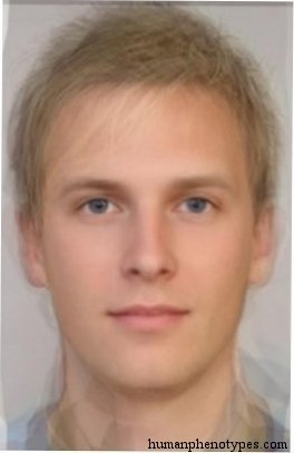
Hallstatt
Central Europe
Nordid proper, resembles the Iron Age remains of the Austrian village of Hallstatt. Most common among Swedes and South Norwegians. Frequent ...
Dinarid (proper)
Southeastern Europe
Central European type typical for mountain and forest regions. Presents the counterpart of Alpinids. The name derives from the Dinaric Alps ...
Alföld
Central Europe
Western Turanid subtype, named after the Alföld (Great Hungarian Plain). It developed when Huns and Magyars entered the area during the earl...
Baskid
Southern Europe
Ancient European type associated with the Basques. Found in its purest form in the Pyrénées-Atlantiques region of Southwestern France, altho...
Test what you learned
Put your eye for regional faces to work in the daily quiz — a composite face, a world map, and your best guess.